Routing, geocoding and analysis, over one gateway.
Routing, geocoding, matrices, isochrones and optimisation as plain JSON over HTTPS. OSRM clients keep their URL shape on /route/v1/{profile}/{coordinates}; Valhalla-shaped clients use /route.
One gateway, six kinds of question answered.
Every endpoint below runs against the live gateway at https://api.mapmap.ai, and the same request/response contract runs identically against a self-hosted deployment.
Turn-by-turn, with truck and ADR costing
POST /route (native JSON, with the ADR extension) and the OSRM-compatible GET /route/v1/{profile}/{coordinates} cover car, truck, bus, bicycle, pedestrian, scooter and motorcycle costing. Declare height, weight and an ADR tunnel code on the truck profile and the restriction shapes the route itself, not a filter applied after the fact. Compatibility is a mapped subset rather than a whole API: the endpoints that map, and every parameter that differs, are listed in the API reference.
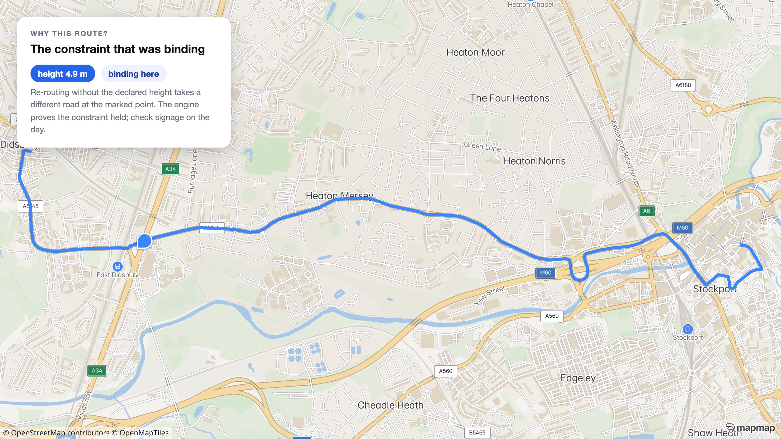
Ask why, get a rationale
Add "rationale": true to a route request and the response names which declared constraint changed the route, computed by re-routing with each one relaxed, never guessed by a language model.
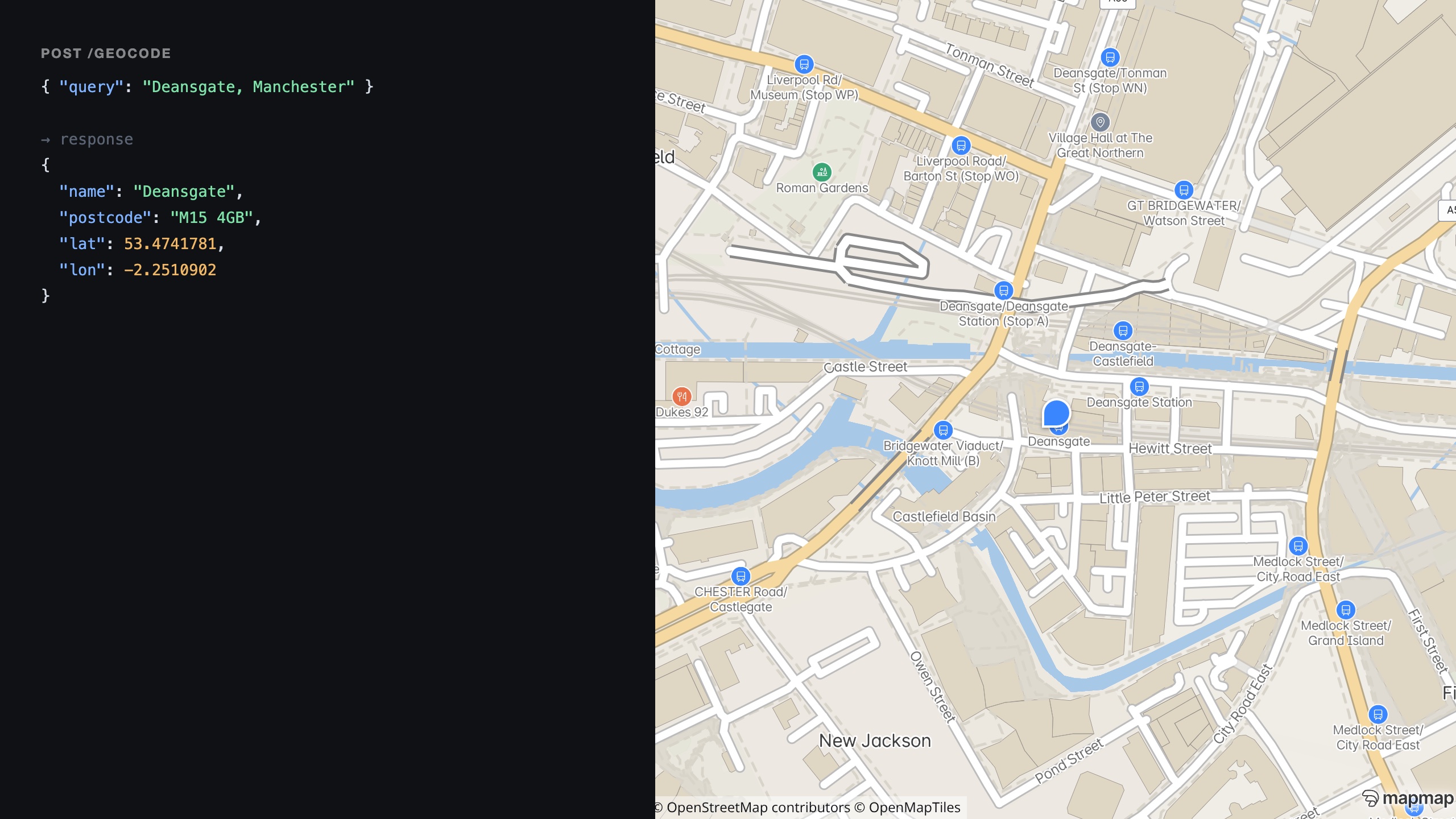
Forward and reverse geocoding
GET /geocode turns free text into ranked coordinates; GET /geocode/reverse turns a point back into the nearest address, street or POI, with opening hours and phone where OpenStreetMap carries them.
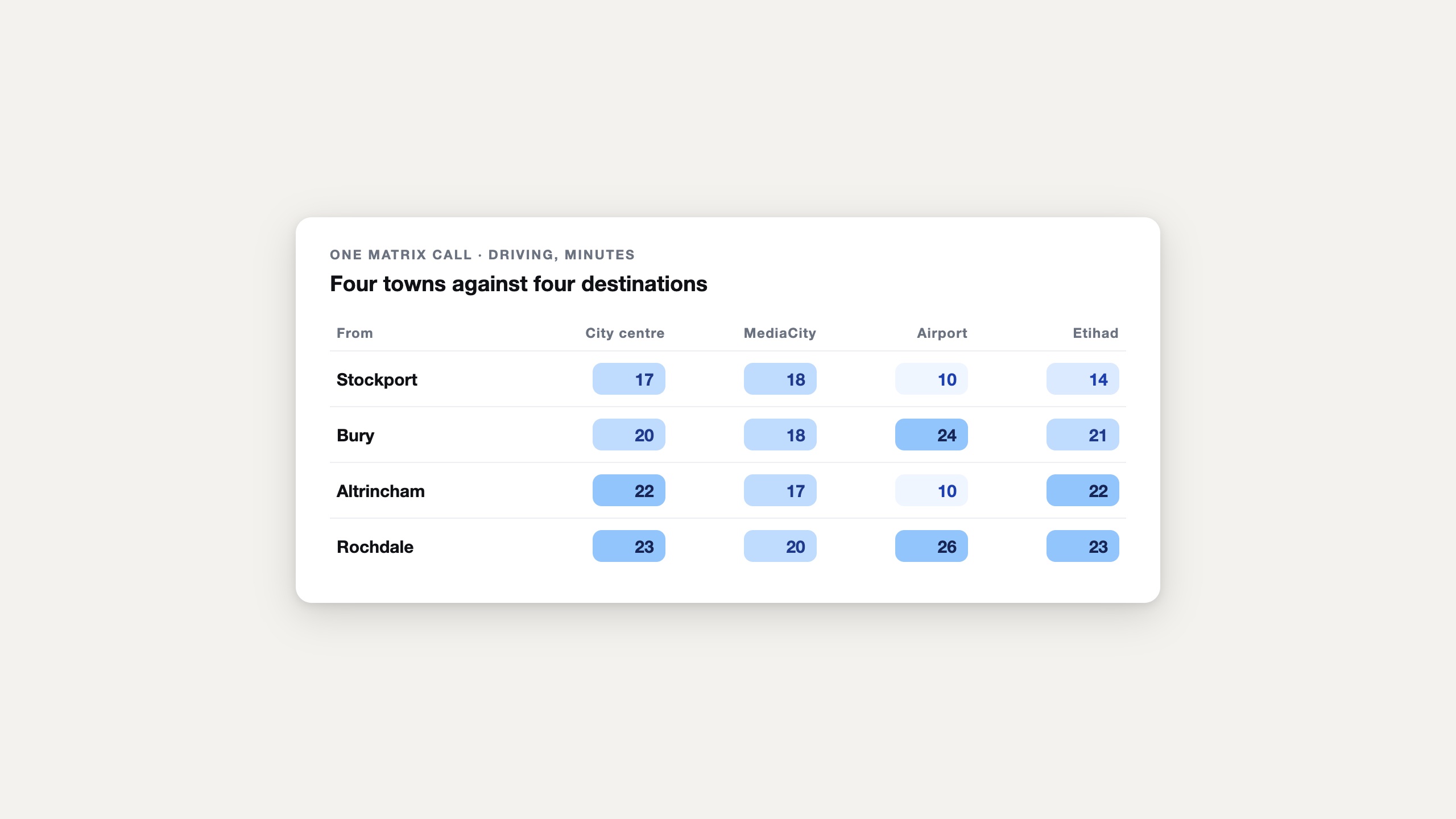
Many-to-many time and distance
POST /matrix scores a grid of sources against targets in one call: duration and distance for every pair, null where a pair is unreachable.
Reachable-area isochrones
POST /isochrone returns reachability polygons as GeoJSON for a time or distance budget, on foot, by bike or by car, from the same engine that does the routing.
Multi-vehicle route optimisation
POST /optimise (also /optimize) plans several vehicles against several stops, with the same truck and ADR constraints as routing, up to the fair-use cap of 200 unique locations per problem.
Coordinates in, either way
Bare coordinate pairs are always lon,lat; JSON bodies use named lat/lon fields instead. Distances are metres, durations are seconds. Full conventions are one click away below.
Measured headroom along a route
POST /v1/clearance/along takes a route shape and a vehicle and walks that corridor over a lidar survey’s own geometry, reading measured surfaces rather than map tags. It answers pass, fail, or an honest refusal over ground the survey did not cover, naming the limiting point, the measured headroom and the bound on it. It is a measurement from a dated survey, never a signed or legal height and never a certificate for the route. A deployment holding no clearance field answers 501, so clients feature-detect on it. How the measurement works
A dimensioned truck route, start to finish.
The first request in the docs, run unmodified: a 44-tonne, 4 m truck carrying an ADR tunnel-code D load, on the OSRM-compatible endpoint.
export BASE=https://api.mapmap.ai
export API_KEY=snk_...

curl "$BASE/route/v1/truck/-0.1276,51.5072;-1.8904,52.4862?height=4.0&weight=44.0&hazmat=true&tunnel_code=D" \
-H "Authorization: Bearer $API_KEY"{
"code": "Ok",
"routes": [
{
"distance": 189199.0,
"duration": 8538.3,
"weight": 8538.3,
"weight_name": "duration",
"geometry": "__kyHh|WDR@L?BAH...",
"legs": ["..."]
}
],
"waypoints": [
{ "name": "", "location": [-0.1276, 51.5072] },
{ "name": "", "location": [-1.8904, 52.4862] }
]
}geometry is an encoded polyline at precision 5; add ?geometries=geojson for raw GeoJSON.
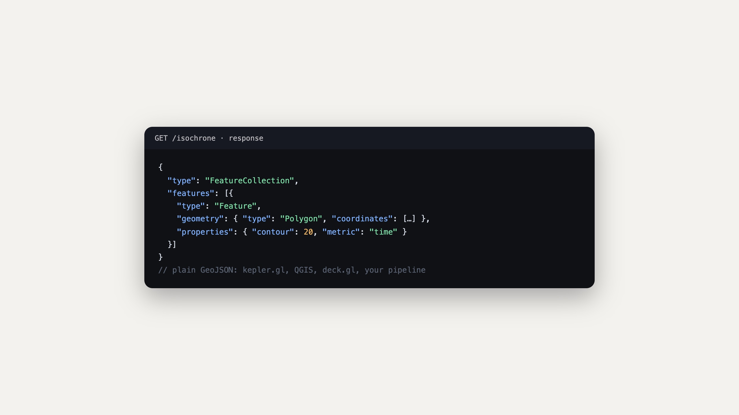
Straight into your GIS stack
Isochrones, matrices and route reports come back as plain GeoJSON, so results drop into kepler.gl, QGIS or deck.gl rather than a proprietary viewer.
An API key is one call away.
POST /v1/keys issues a provisional key from an email address and acceptance of the terms. Verify the email and the free tier unlocks: 50,000 calls a month, card-free.
Self-hosted deployments run the identical gateway, so the same request shapes, keys and error envelope carry over if you ever move the API onto your own infrastructure.
The docs, not marketing copy.
Every endpoint, parameter and error above is documented in full, with the same examples run against the live gateway.
Every endpoint, in full
Routing, geocoding, matrix, isochrone, optimisation, places and the rest, with request and response shapes and the truck and ADR parameters.
Auth, units, errors, quotas
Coordinate order, the RFC 9457 error envelope, the two 402s, and the full ADR tunnel-code table. The cross-cutting rules every endpoint follows.
Key to routed truck
From an email address to a dimensioned, ADR-aware truck route in a couple of calls.
Isochrones, matrices, map matching
The reachability, scoring and trace-matching endpoints behind catchment, territory and coverage work.
Point your app at the gateway.
Routing, geocoding, matrix, isochrone and optimisation, all behind one key. 50,000 free calls a month, card-free, no sales call required to start.