Search by commute, not by circle.
A radius search lies about cities. Isochrones on the real road network answer what buyers actually ask: what can I reach in twenty minutes? Matrices score every listing against work and school.
From search to shortlist with honest travel times.
The buyer journey is a chain of location questions. Each one below maps to one shipped tool.
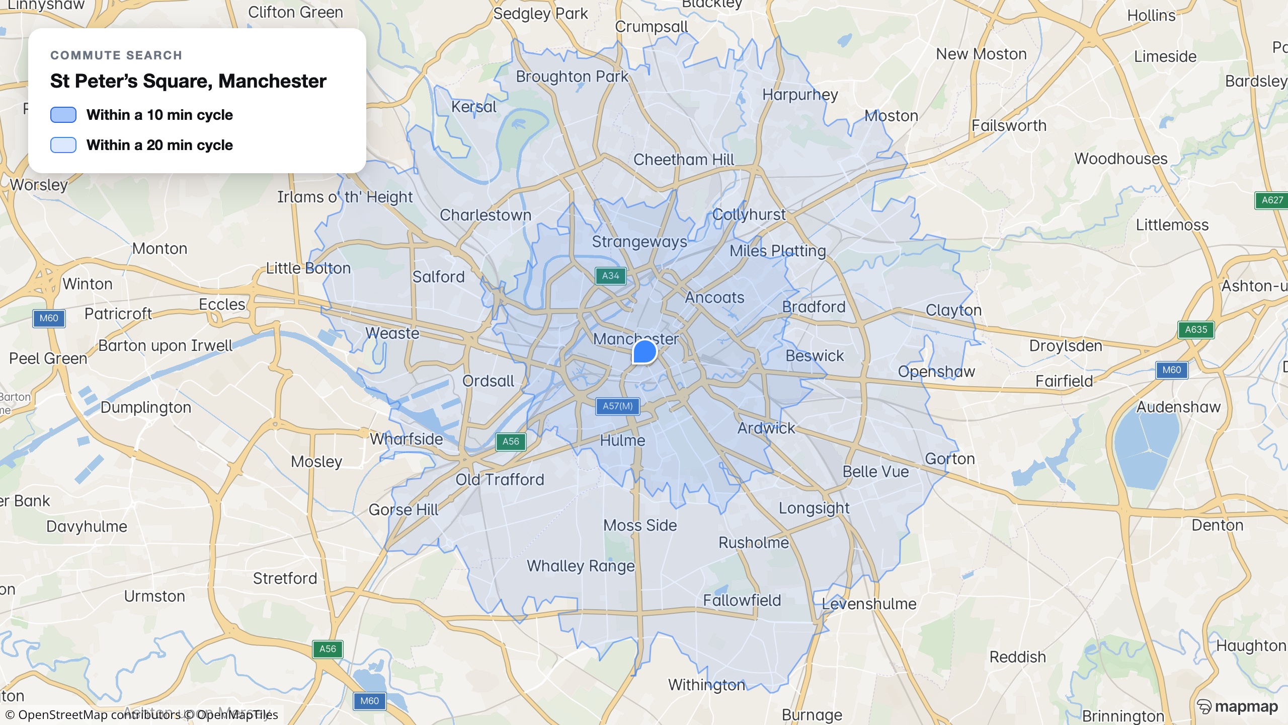
What can I reach in twenty minutes?
Drive, cycle and walk isochrones from any point on the real road network, intersected with your listings: commute-first search instead of a radius that pretends every direction is equal.
See isochrones live →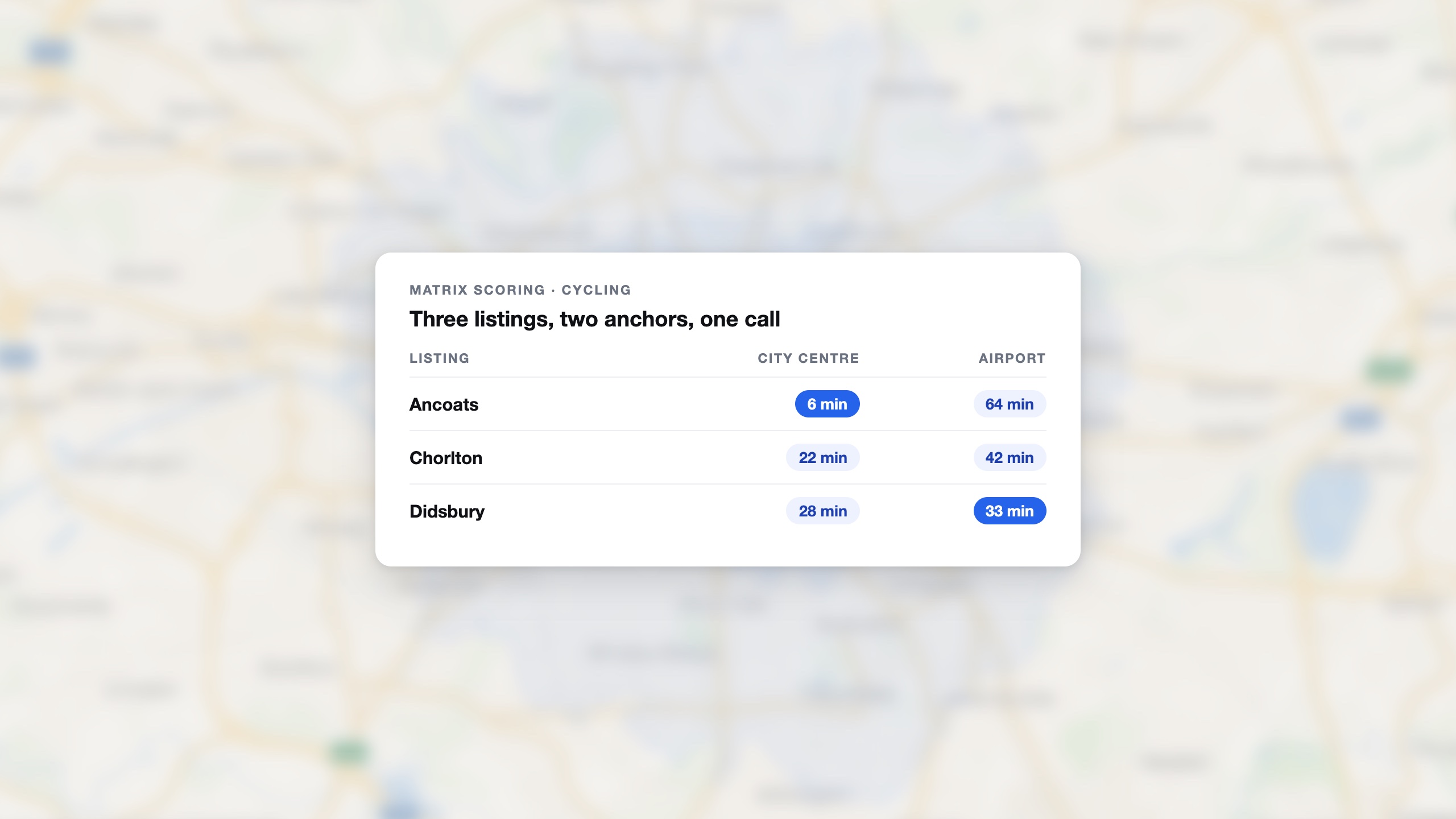
Score every listing against real life
One matrix call scores a whole results page against the buyer's anchors. These are real cycling times, not crow-flies.
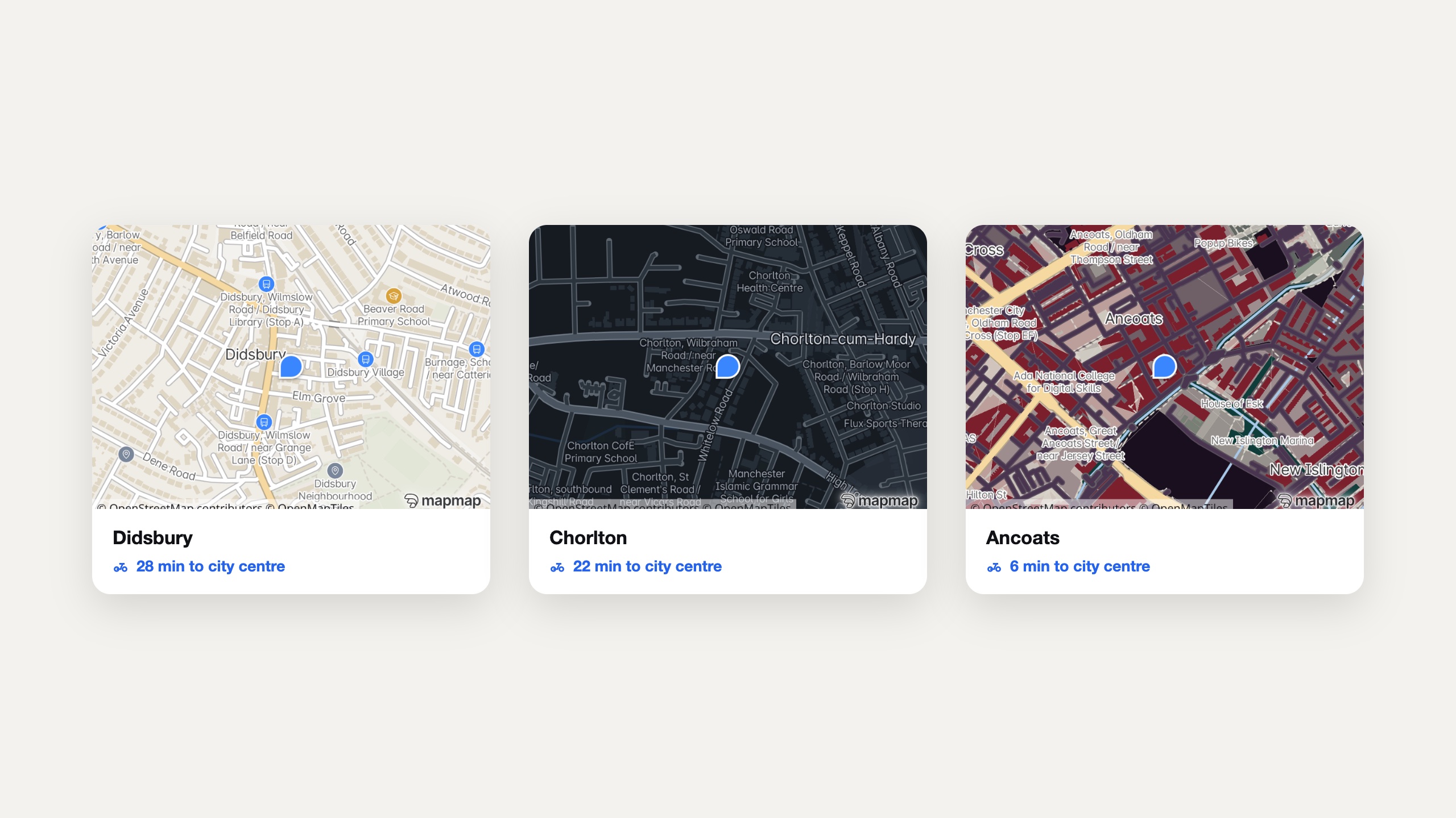
A branded map on every listing
Static map images render the location map for every listing page, email and PDF from your own deployment, styled to the portal's brand. Portfolio-scale volume costs nothing per request.
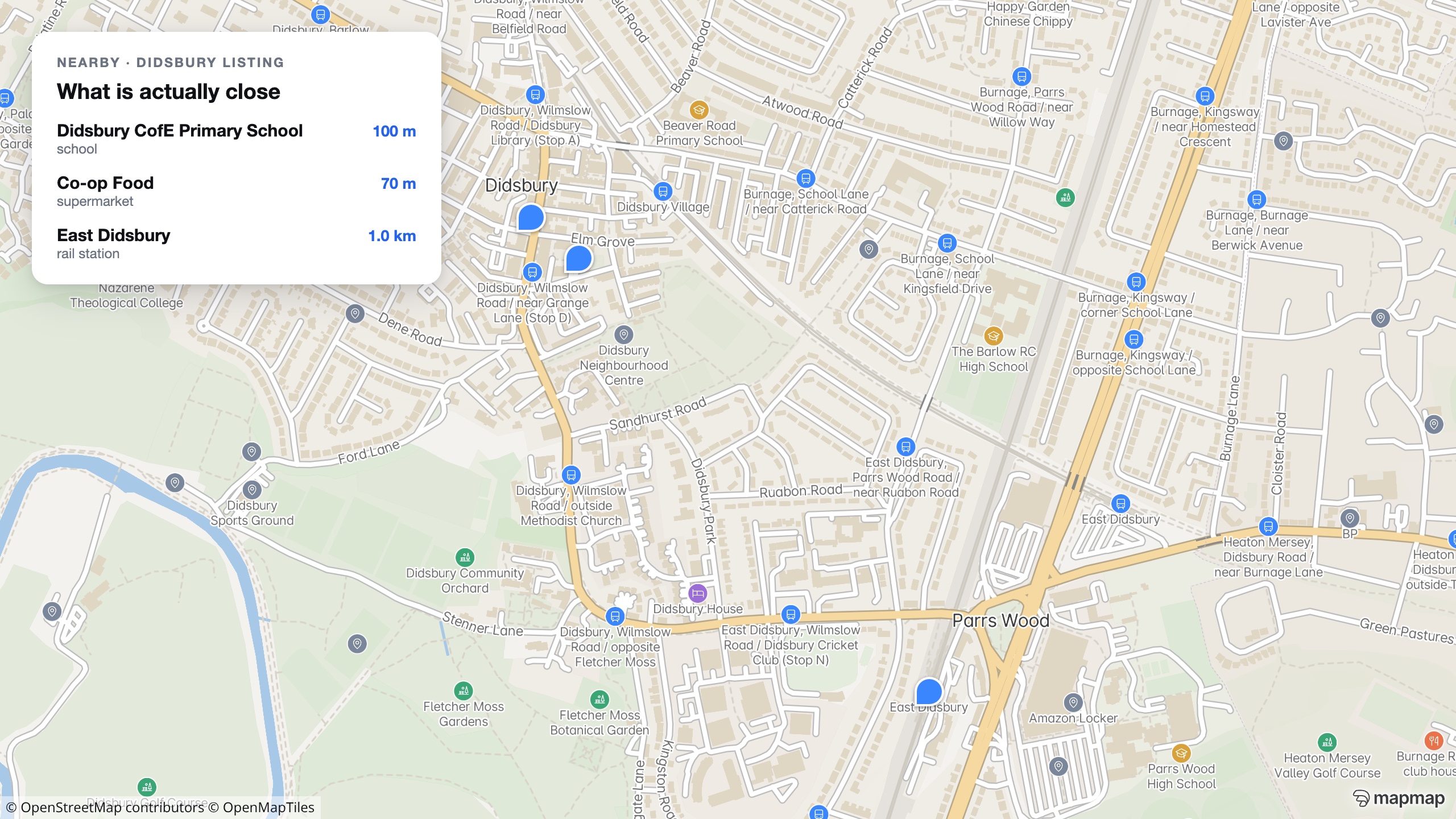
What is actually nearby
Nearby-place search answers by category: schools, stations, pharmacies, supermarkets, nearest first with real distances. Honest context from open data your users can check.
Listing data that stays yours
Your listings and your users' search patterns are the business. Self-hosted, neither transits a third-party map provider, and there is no per-load metering on your busiest pages.
Property copilots with real answers
The hosted MCP server gives AI agents geocoding, isochrones, matrices and place search, so a copilot can answer “a flat within 25 minutes of the office by bike” with engine-computed truth.
Commute times cover driving, cycling and walking on the road network. The platform does not compute public-transport journey times, so a rail-commute search is not something we will claim until it is real.
Sample listings and three commute anchors.
Our AI agents will build commute-first search across your listings, with real isochrones and matrix scoring behind the ranking, on branded listing maps.
What you are actually being offered.
On the page, not in the small print: the scope, the deliverable, the timetable and how the money works, before you spend an hour on a call finding out.
- Who it is for
- A portal or agency whose search still draws circles on a map when buyers think in commutes.
- What is in scope
- Sample listings and three commute anchors are enough. We build commute-first search across them, with isochrones and matrix scoring behind the ranking.
- What you get
- Commute-first search on your own listings, with branded listing maps and the ranking arithmetic visible rather than a black box.
- How long
- Days rather than months, with the date agreed on the call.
- What it costs
- Scoped on the call. Isochrone and matrix calls are metered on the published rate card.
- Next step
- Send sample listings and three commute anchors, and we will rank them by commute rather than by radius.
Automotive
MapMap in the vehicle: a full navigation stack you host and control.
Trucking & Logistics
The router that refuses the bridges the map records, before your driver sees them, with dispatch-grade optimisation built in.
Fleet Optimisation & Dispatch
Plan the whole shift against skills, windows, capacities and rest, then follow it without handing anyone your drivers' positions.