Find the gaps. Plan the sites. Route the range honestly.
Drive-time coverage against real residents shows exactly where the network is thin. Elevation profiles feed range modelling, with a null where there is no coverage rather than a guess.
From site planning to the driver's range ring.
The gap analysis and the driver-facing app below are both live: one plans the network, the other proves the developer experience.
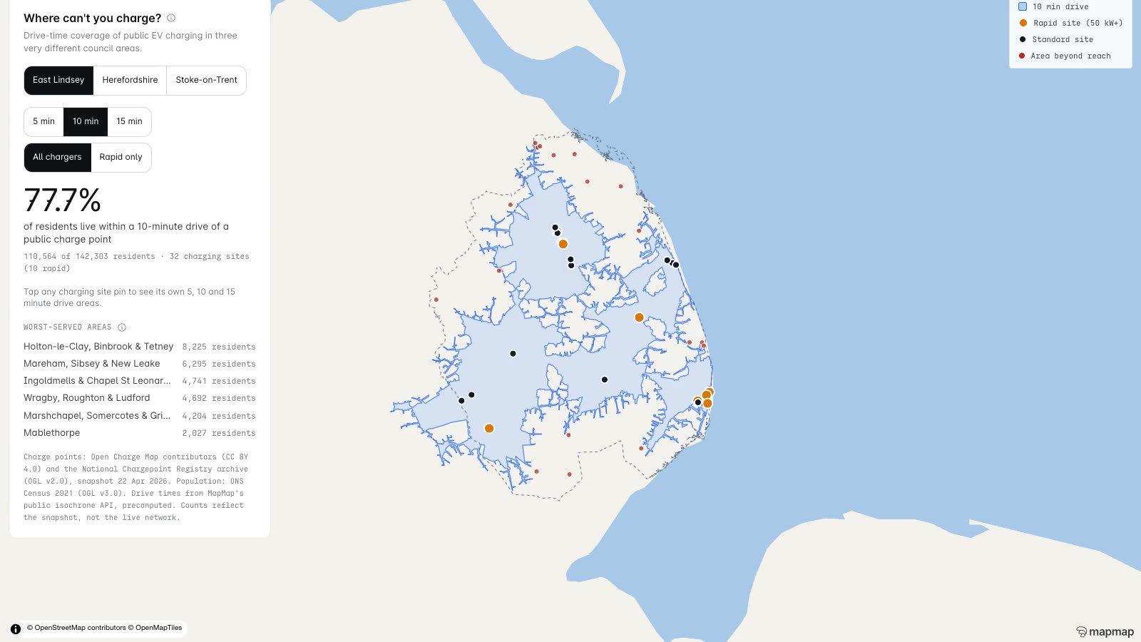
Where the network doesn't reach
Drive-time coverage from every public charge point in East Lindsey, Herefordshire and Stoke-on-Trent, measured against Census 2021 population centroids. Toggle to rapid-only and the coverage collapses.
Open the gap finder →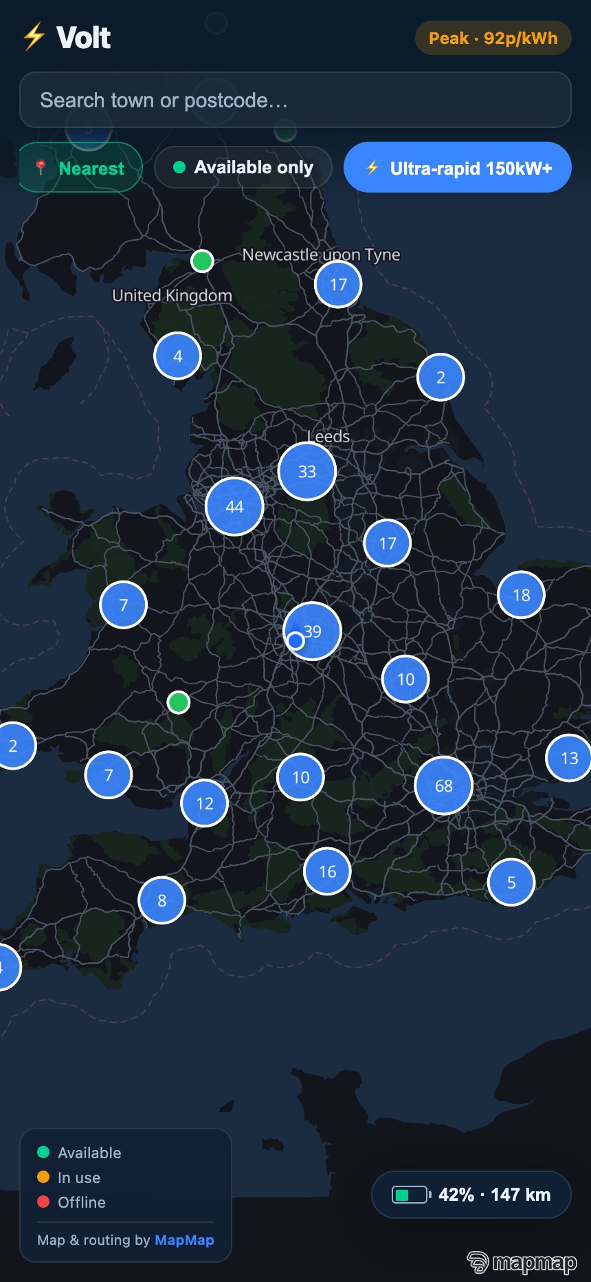
909 real sites, a working app
A full EV-charging companion across 909 real UK sites, filterable by connector and power, built by AI agents in under a day.
See the showcase →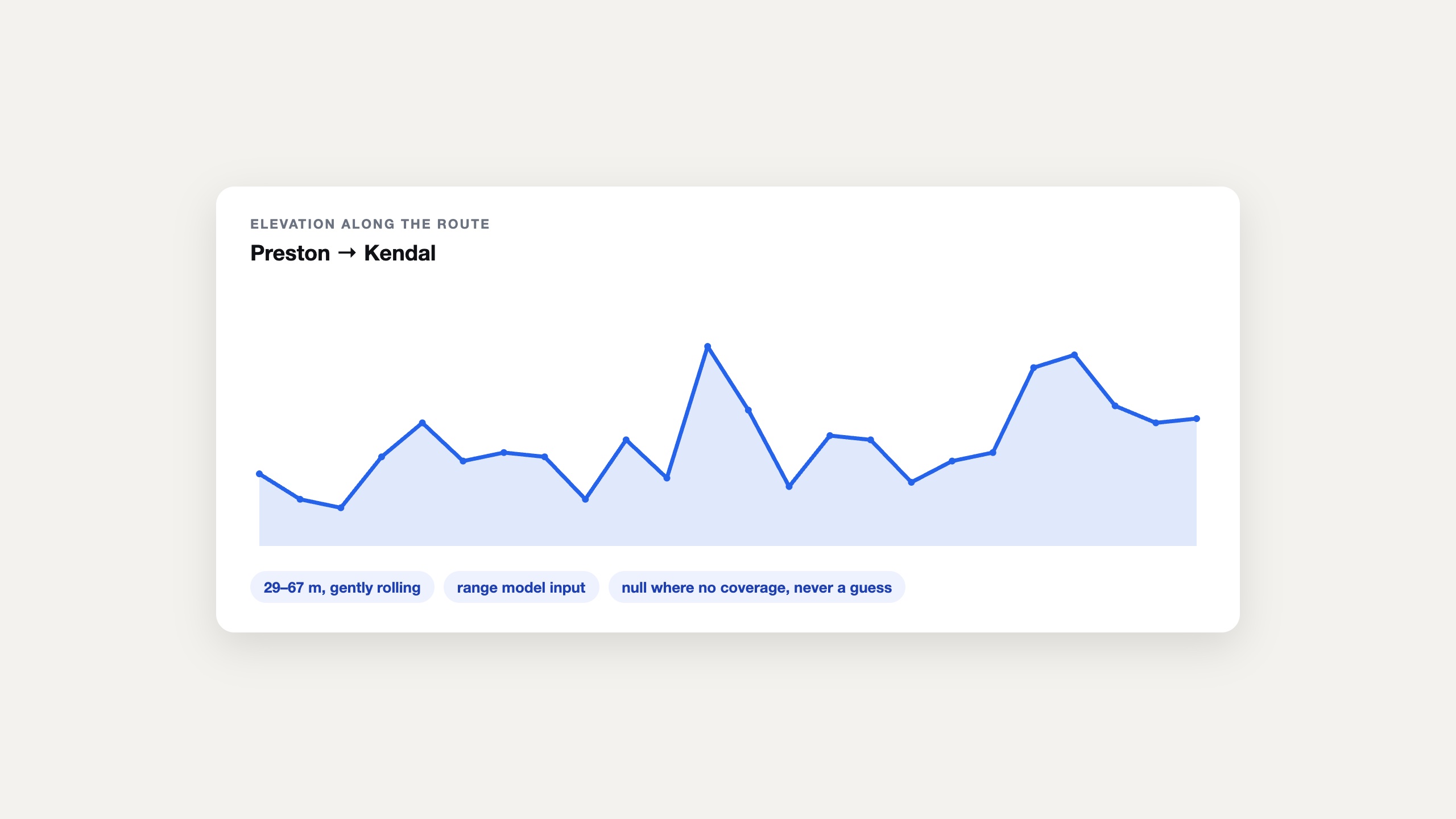
Elevation profiles for range modelling
Elevation along the route feeds range and fuel modelling: a null where there is no coverage, never a guess dressed up as a number. The same profile sits behind the showcase app's range ring.
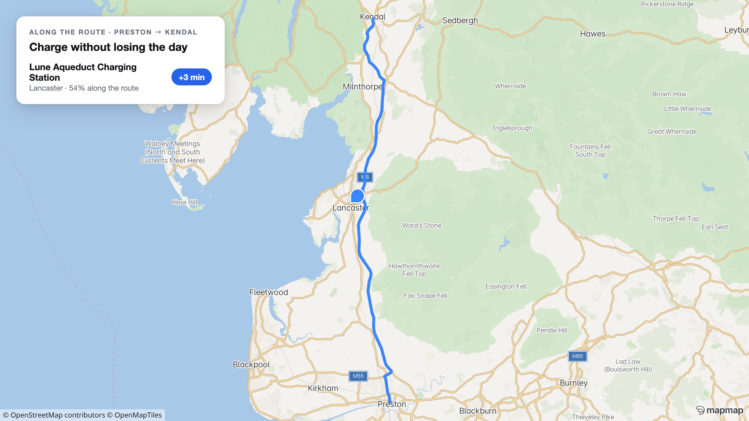
Chargers with an honest detour cost
Search along a route returns charging stops with their real engine-computed detour, so an app can say what a stop costs the journey. On Preston to Kendal, the Lune Aqueduct station adds three minutes.
No per-call metering on your own box
Docker distribution and signed territory packages: a self-hosted deployment has no metering between your app and your drivers.

An API key in one call
A hosted MCP server, one-step installs for Claude, Cursor and VS Code, and a card-free API key with no sales call. Route to a charger and draw a range ring this afternoon.
Coverage percentages come from open charge-point registries and Census centroids, not live network telemetry. Registries carry stale and dead entries, so treat site counts as indicative, and a driver being inside a drive-time ring says nothing about whether that charger is working, free or affordable right now.
Give us your site list and a coverage target.
The 909-site charging app in our showcase runs on the same SDK and gateway, built in under a day. Our AI agents will build your site-planning model the same way.
What you are actually being offered.
On the page, not in the small print: the scope, the deliverable, the timetable and how the money works, before you spend an hour on a call finding out.
- Who it is for
- A charge point operator or site developer deciding where the next chargers go.
- What is in scope
- You give us your site list and a coverage target. We build the site-planning model on it: drive-time coverage, the gaps, and the residents each candidate site reaches.
- What you get
- A working gap model on your own sites, and the driver-facing map if you want one, built on the same SDK and gateway as the 909-site app in our showcase.
- How long
- Days rather than months. The showcase charging app was built in under a day.
- What it costs
- Scoped on the call. Hosted API pricing is published; a self-host licence is quoted per deployment.
- Next step
- Send the site list and the coverage target, and we will show you where the gaps actually are.
Automotive
MapMap in the vehicle: a full navigation stack you host and control.
Trucking & Logistics
The router that refuses the bridges the map records, before your driver sees them, with dispatch-grade optimisation built in.
Fleet Optimisation & Dispatch
Plan the whole shift against skills, windows, capacities and rest, then follow it without handing anyone your drivers' positions.